 Any quick search of Google will reveal a great many different maps that exist for the City of Charleston and surrounding barrier islands. Historic maps, Google maps, utility maps even City GIS (Geographic Information Systems) maps. There are plenty of maps to view, but until now, no simple way to view the historic city and the infrastructure that goes into its makeup.
Let us look at some existing examples:
South Carolina Information Highway: This map lets you look through fairly static maps from the County, City and National Parks Service plus a few additions.
City of Charleston : Much more information here (does not integrate well with Apple computers), lets you look at tax and property plats, zoning districts and a whole lot more but again, typically in discrete layers.
Charleston County : Good data here. Mainly modern, pertinent data to the operation of a modern city. Voting patterns, Council members and districts, recycling depots etc.
Historic Charleston Foundation & The Preservation Society of Charleston – multiple historic maps, dated until about 1850. The scale is rather erratic but improves greatly from that point onwards. Lots of background information for those who want to dig further.
So what is new?
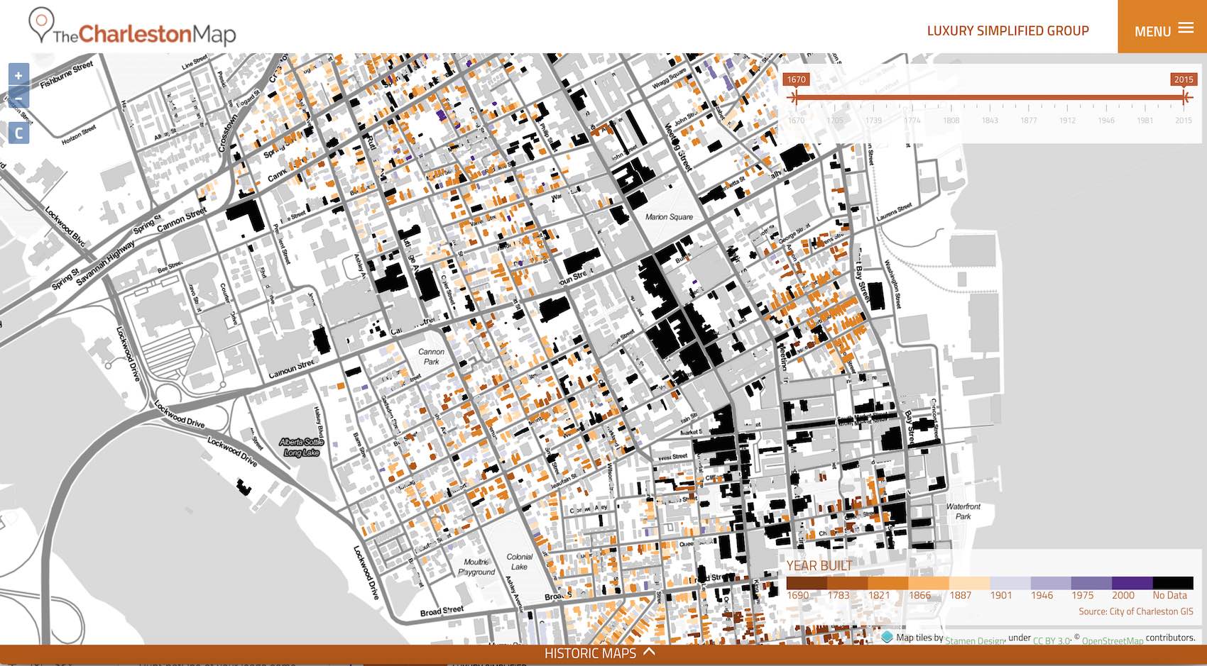
For those who want to get “under the skin ” of the historic city there is now a new option available. The Charleston Map (www.thecharlestonmap.com) is a compilation of modern and historic data for the city of Charleston overlaid with building data and satellite images. Presented in a myriad of layered options, each you can select and view that serves up the data in whatever way that you choose.
Here are just a few of the ways for example:
- It allows multiple layers and views of the city for example, historic homes overlaid on a street map.
- Homes can be filtered by height, age, or value shown on a historic street map.
- Historic maps manipulated to accurately overlay modern street coordinates.
Addendum: this project is a collaborative effort authored by our group and will continue to grow and evolve over time. We would welcome your ideas and suggestions to improve its use or add additional layers as it develops, simply share your comments below.
Enjoy and have fun in this great city of ours!
Interested in Learning More?
Our expert teams - from development, investment, real estate, and property management - have experienced it all and have the insight to help you along the way.
Find Out More